GeoPad: A Versatile Tool for Geo Positioning
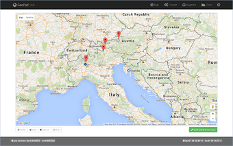
GeoPad is a free Chrome add-on designed for developers who need to manage geo positioning and perform spatial calculations. Utilizing Google Maps cartography and various open-source projects, GeoPad enables users to calculate distances between coordinates, estimate travel times based on speed, and identify latitude and longitude from draggable markers on the map. Additionally, it can display the current device location when available, making it a practical tool for location-based applications.
Beyond basic calculations, GeoPad offers a range of features including conversions between decimal and sexagesimal coordinates, distance measurements in various units, and speed conversions. It also allows users to create visual scenarios on maps with markers and generate charts for presentations, enhancing the utility of the tool for developers. This early preview version invites users to report any bugs or issues to improve the experience.